-
Visit and learn
- Message from the Speaker
- About Us
- Visitors
- Visit the Public Gallery
- Visit our Gift Shop
- Have Your Say
- Get Involved
- Education and Learning
- History
- Heritage Collections
- Preservation of our Heritage
- Regional Sittings
- CPA Australia and Pacific Regional Conference
- Publications and Reports
- Speakers' Corner
- Opening of the 58th Parliament
- Parliamentary Annexe Reparation and Refurbishment
- Contact Us
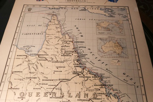
In 2022, ten historically significant maps were identified for restoration. The conservation of these maps, some of which have been held by the Parliament since 1899, will allow them to be displayed from time to time and shared with the people of Queensland.
These maps are unique to the Parliamentary Library and possess historical information and context that does not exist elsewhere in Australia. The provenance of these maps can be traced to at least 1899 and their appropriate conservation will enhance the reputation of the O’Donovan Library as a heritage library. Among these rare maps, one notable example is the pioneering map of Queensland, crafted by Leopold Franz Landsberg in 1860. Additionally, there is the inaugural official map, commissioned by the Queensland Government in 1871. This map is particularly remarkable as it intricately delineates electoral boundaries, all hand-drawn using distinctive red ink.
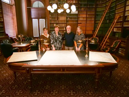
In this video, Ruth Nitkiewicz, a librarian at Queensland Parliament, introduces special guests Bill Kitson and Kaye Nardella from the Queensland Museum of Lands, Mapping and Surveying. The focus of the discussion is on a collection of Queensland maps that have undergone restoration as part of the Queensland Parliament Heritage Conservation Program. Ruth and her guests delve into the significance of these restored maps, shedding light on their historical and cultural importance.
The conservation works were completed by RSM Art Conservation in Brisbane, one of the few large format paper conservation specialist in Australia.
The Queensland Parliament Heritage Conservation Program, conducted in collaboration with the Parliamentary Library and Property Services, exemplifies the commitment to preserve and showcase these valuable pieces of Queensland's heritage.